Building the Path Forward: A Guide to the Standards Shaping Bicycle Infrastructure
5 min read
For decades, the design of our streets centered almost exclusively on the movement of motorized vehicles. However, as cities and towns aim to reduce congestion, improve public health, and lower carbon emissions, the focus has shifted toward "active transport." At the heart of this shift is bicycle infrastructure—a category that includes everything from painted lanes on a busy boulevard to winding multi-use paths through a park.
Understanding the "rules of the road" for bicycle infrastructure can be confusing. Unlike building a house or starting a business, which often involves a clear list of federal or state permits, bicycle infrastructure occupies a unique space in the regulatory world. In fact, many high-level databases show zero specific federal regulations or direct permits for bicycle infrastructure.
This doesn't mean the "Wild West" prevails; rather, it indicates that the governance of bike lanes and paths is a tapestry of local engineering standards, city planning ordinances, and regional safety guidelines rather than a single, centralized permitting system. Here is a look at the factors that shape these environments and why the rules look the way they do.
Why the Rules Often Feel "Invisible"
If you look at the raw statistics for bicycle infrastructure oversight at a national level, the numbers can be surprising. Many data sources report a count of zero regulations and zero permits. This is because bicycle lanes are typically considered a component of the existing roadway rather than a separate, standalone utility.
Instead of a single "Bicycle Lane Permit," the development of these routes is driven by:
- Design Manuals: Professional organizations and state departments of transportation provide technical blueprints for what a lane should look like.
- Urban Planning Policies: City councils set goals for "connectivity," deciding where lanes should go based on community needs.
- Public Safety Standards: The primary driver for any rule is the reduction of conflict between different types of road users.
Because these are often internal government design standards rather than external "permits" that a citizen applies for, they don't always appear in traditional regulatory counts. However, the factors that dictate their design are very real and highly technical.
The Key Factors Shaping Bicycle Routes
When engineers sit down to design a bike path or a designated route, they aren't just drawing lines on a map. They are balancing a variety of physical and environmental factors to ensure the path is safe, durable, and useful.
Traffic Volume and Speed
The most significant factor in determining the type of bicycle infrastructure used is the speed and volume of adjacent motor vehicle traffic. On a quiet residential street with low speeds, a "sharrow" (a painted symbol indicating a shared lane) might be sufficient.
However, as traffic volume increases, the "suitability rating" of the road for cyclists drops. On high-speed arterials, regulations often require physical separation—such as concrete curbs or plastic bollards—to protect cyclists. The goal is to minimize the "differential speed" between a person pedaling at 12 miles per hour and a car driving at 45 miles per hour.
Gross Vehicle Weight and Pavement Durability
While bicycles themselves are light, the infrastructure they use must account for the weight of other vehicles. In areas where bike lanes are adjacent to loading zones, the "gross vehicle weight" of delivery trucks is a major consideration.
Engineers must ensure that the pavement thickness and the drainage systems can handle the pressure of heavy vehicles that might occasionally veer into or cross the bike lane. If the pavement is too thin, it will crack and create hazards for thin bicycle tires. This is why you often see bike lanes constructed with the same heavy-duty materials as the main roadway.
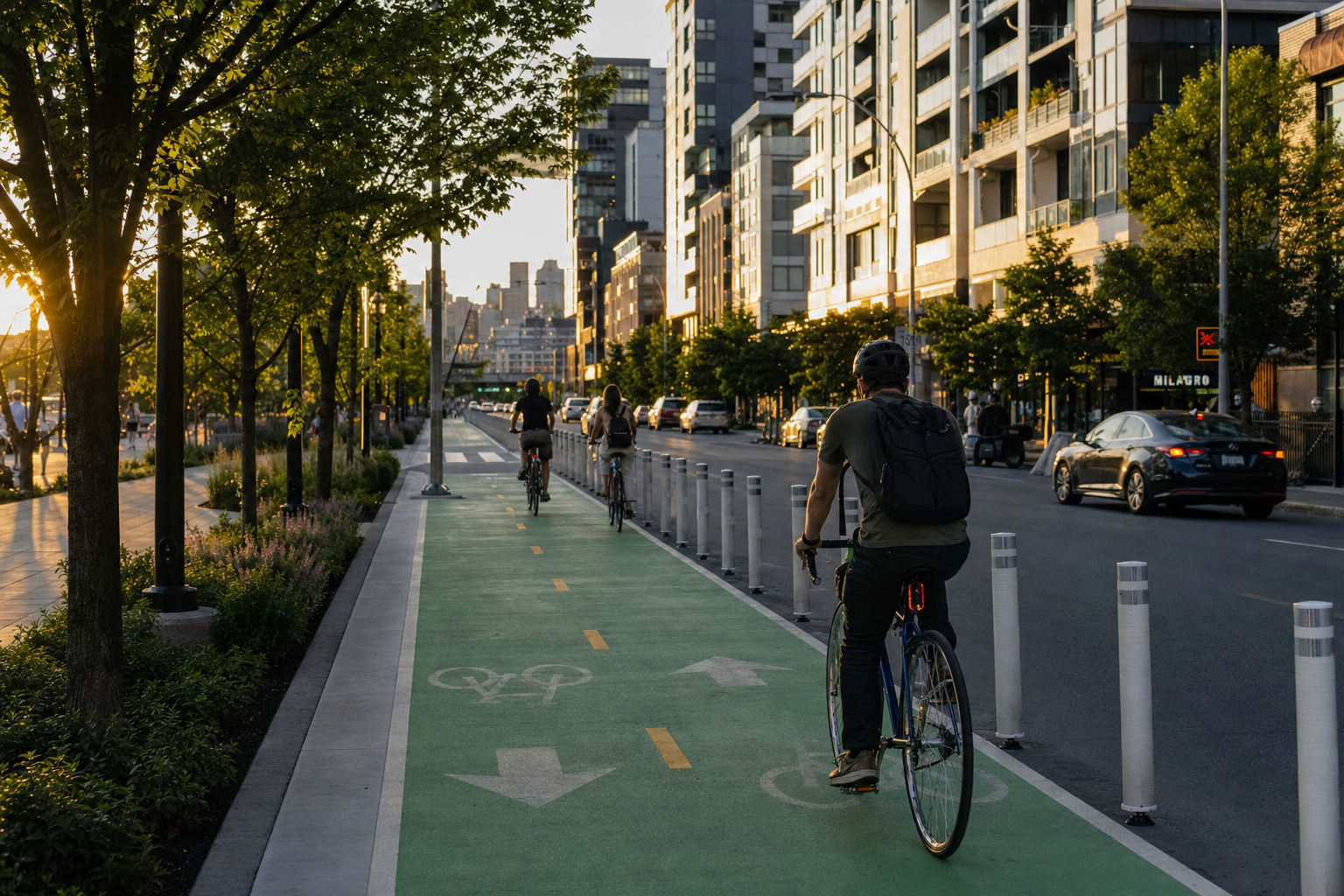
Lane Width and Clearance
The width of a bicycle lane is not arbitrary. It is calculated based on the "operating envelope" of a cyclist—the amount of space a person needs to balance and pedal without hitting a curb or being too close to passing cars.
Standard lanes are typically five to six feet wide. However, factors like "door zones" (the space needed to avoid opening car doors) can increase the required width. If a path is "multi-use"—meaning it accommodates pedestrians, runners, and cyclists—the width requirements increase significantly to prevent collisions between users traveling at different speeds.
Suitability Ratings and Connectivity
One of the most important aspects of bicycle infrastructure is the "suitability rating." This is a way for planners to grade a street based on how comfortable it feels for an average rider. Factors that go into this rating include:
- Pavement Quality: Is the surface smooth, or is it riddled with potholes and debris?
- Grade and Slope: How steep is the incline? High-suitability routes try to minimize grueling climbs to remain accessible to all ages.
- Intersections: How does the bike lane handle a right-hand turn for a car? Intersection design is where the majority of "rules" are applied, as these are the most common points of conflict.
Connectivity is the other half of the equation. A mile-long, perfectly protected bike lane is of little use if it doesn't connect to other routes. Modern infrastructure planning focuses on creating a "network" rather than isolated segments, ensuring that a cyclist can get from their home to a grocery store or office without being forced into unsafe traffic conditions.
Regional Variations: Why Rules Change by Location
Because there is no single federal mandate for bicycle infrastructure, you will see a high degree of regional variation.
- Urban Centers: In dense cities, the focus is often on "protected intersections" and signal priority, where cyclists get a green light a few seconds before cars.
- Suburban Areas: Here, the focus is often on "sidepaths" or "greenways" that run parallel to major roads but are physically removed from the pavement.
- Rural Routes: In less populated areas, "designated routes" might simply be wide shoulders on a highway with specific signage alerting drivers to the presence of cyclists.
These regional differences are shaped by local climate, existing road widths, and the legal framework of the state. Some states have "vulnerable user laws" that influence how infrastructure is designed, while others rely more heavily on traditional engineering manuals.
A Focus on Predictability
Ultimately, the reason these guidelines exist—even if they aren't labeled as "permits"—is to create predictability. When a driver knows exactly where a cyclist is supposed to be, and a cyclist knows exactly how a car will behave at an intersection, the road becomes safer for everyone.
The absence of a massive federal regulatory framework for bicycle infrastructure actually allows local communities to be more flexible. It enables a city in a snowy climate to design lanes that can be cleared by snowplows, or a coastal city to use materials that withstand salt air.
While the data may show "0 regulations," the reality is a deeply considered, scientifically backed approach to moving people safely through their communities. As we continue to redefine what a "street" looks like, these factors—speed, weight, width, and connectivity—will remain the pillars of modern transport design.